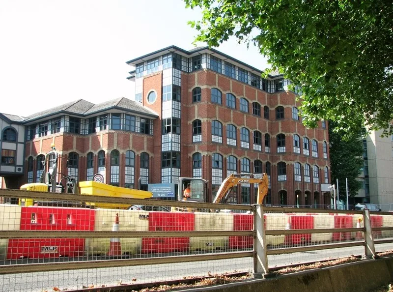

Dibden Road is shut from today until 2028, Mousehold Street is proposed to close on Wednesday, and two A47 slip roads go overnight. Every closure in force.
Two authorities are responsible for Norwich roadworks and neither of them is the city council. Norfolk County Council is the highway authority for every street in the city. National Highways looks after the A47 and the A11. The city council does bins, parking and planning. Knowing which one to check saves a lot of time.
Everything below comes from the authorities’ own notices, re-checked on 21 September 2026.
The week ahead, in order
Two things start today. Dibden Road closes for two years and the city’s car park charges go up. The A11 weekend closure at Thickthorn is over: the road reopened at 06:00 on Sunday 20 September, a day earlier than National Highways had published.
- From today, Monday 21 September: part of Dibden Road closes for building development work and is booked to stay shut until 17 October 2028. City car park charges also change today.
- Tuesday 22 September, 8pm, to Wednesday 23 September, 6am: the A47 eastbound entry slip at Postwick closes overnight.
- Wednesday 23 September, 8pm, to Thursday 24 September, 6am: the A47 eastbound entry slip at Trowse closes overnight.
- Wednesday 23 to Friday 25 September, 7pm to 6am: the B1150 North Walsham Road closes overnight just north of Broadland Northway.
- Wednesday 23 to Wednesday 30 September: Mousehold Street is proposed to close between Silver Road and Brewers Court. No order confirming it has been published yet.
- Friday 25 September: Onley Street and Leicester Street are due back, and so are Blind Lane in Newton St Faith and Green Lane in Great Plumstead.
- Friday 2 October: Back Street in Newton St Faith is due back.
- Saturday 3 and Sunday 4 October: no trains between Norwich and Ely.
- October: National Highways switches the A47 contraflow at Thickthorn.
What is closed in Norwich now
These orders have been made and are in force. The dates are the ones the council published. Every order can legally run to a much later backstop date if the work overruns, and that date is given in brackets.
| Road | Work | Dates | Promoter |
|---|---|---|---|
| Alexandra Road | Lead water pipe replacement, in two phases. Dereham Road to Stafford Street, then Stafford Street to Earlham Road | 7 September to 13 November (backstop 13 May 2027) | Anglian Water |
| St Leonards Road, Marion Road, Florence Road, Beatrice Road, Quebec Road, Hill House Road | Drainage. Four short lengths closed to vehicles, six more under a no parking, stopping or loading ban on both sides | 31 August to 30 October (backstop 30 April 2027) | Norfolk County Council |
| Onley Street and Leicester Street | Gas main replacement. Onley Street from Unthank Road to Leicester Street, Leicester Street from Onley Street to Gloucester Street | 10 August to 25 September (backstop 25 March 2027) | Norfolk County Council |
| All Saints Green | No parking, stopping or loading on the west side, from 30m north-east of Surrey Street for 60m, for a materials compound | 3 August to 30 October (backstop 30 April 2027) | Norfolk County Council |
| North Walsham Road, Sprowston | High voltage cable laying, Barkers Lane to Edwards Road | 24 August to 13 November (backstop 13 May 2027) | SSE Pipelines |
| Old Norwich Road, Newton St Faith | Gas main replacement, Crown Road to Blind Lane | 1 September to 5 October (backstop 5 April 2027) | Cadent |
| Reepham Road, Drayton | 30mph limit while a roundabout is built for a new housing development, Broadland Northway roundabout to Drewray Drive | 17 August 2026 to 28 March 2027 (backstop 16 February 2028) | Breheny Civil Engineering |
Alexandra Road is the longest job in the city, and the order has now been made rather than merely proposed. Anglian Water is replacing lead water pipes between Dereham Road and Earlham Road, and the closure runs to 13 November:
- Phase A: Dereham Road to Stafford Street. Diversion via Dereham Road, Gladstone Street and Stafford Street.
- Phase B: Stafford Street to Earlham Road. Diversion via Earlham Road, Gladstone Street and Stafford Street.
The notice says the two phases are not expected to run at the same time, so one end of the road should stay open throughout.
The Thorpe Hamlet drainage job is the one that catches residents out, because most of it is a parking ban rather than a closure. Short lengths of St Leonards Road, Marion Road, Florence Road and Beatrice Road are shut to vehicles, with pedestrian access kept. On top of that, longer stretches of St Leonards Road, Marion Road, Florence Road, Beatrice Road, Quebec Road and Hill House Road are under a ban on parking, stopping, loading and unloading on both sides of the carriageway until 30 October. The signed way round is Rosary Road, Thorpe Road, Telegraph Lane East, Telegraph Lane West and Quebec Road eastbound, and the reverse plus Carrow Road and Clarence Road westbound.
Onley Street is due back on Friday. The gas main work in the Golden Triangle is booked to 25 September, and the diversion is Gloucester Street and Unthank Road. The order allows it to run to 25 March 2027 if it overruns.
Finished: Hellesdon Hall Road and Armes Street
Both of these were made orders on Norfolk County Council’s Norwich notice of 11 September and both have now run their published course.
- Hellesdon Hall Road, from Low Road to Rotary Court, carriageway patching, 14 to 18 September. The order allows the work to continue to 30 October if it is not finished, so the signs may still be up.
- Armes Street, from 5m west of Northumberland Street for 20m westwards, carriageway patching, 17 to 19 September. That order runs to a backstop of 31 October.
Still only proposed: Mousehold Street, 23 to 30 September
The 11 September notice gives the city’s next closure, and it has not been confirmed. Mousehold Street, from Silver Road to Brewers Court, would close from 23 to 30 September (may continue to 11 November) for UK Power Networks to install an electrical service. The signed way round is Mousehold Street, St James Close, Barrack Street and Silver Road.
Norfolk County Council usually publishes a notice making an order in the week or two after proposing it. It has published no Norwich or Norfolk traffic bundle since 11 September, so as of today there is no made order for Mousehold Street on the public record. Treat Wednesday as likely rather than certain.
Shut from today for two years: Dibden Road
One order stands out for its length, and it starts today. Dibden Road, from 50m east of Crome Road for 40m eastwards, closes for building development works from 21 September 2026 to 17 October 2028. The notice gives no alternative route, and Norfolk County Council is the promoter, making the order under both section 14(1) and section 15(2) of the Road Traffic Regulation Act 1984.
Two years is long even for a development closure. The order covers 40 metres of Dibden Road east of the Crome Road junction, not the whole street, so it is the through route past the site that goes.
On the edge of the city
- Hethersett Lane, Colney, from Braymeadow Lane for 800m northwards, is closed for footway reconstruction from 7 September to 24 December 2026, with a backstop of 6 March 2028. The order has been made. The signed route is Watton Road, the A47, Norwich Road and Colney Lane. That is the road network around the Norfolk and Norwich University Hospital and the research park, so allow extra time if you drive to an appointment.
- Newton St Faith gas main work keeps moving round the village. Blind Lane, west of Old Norwich Road, is closed to 25 September and Back Street, from Blind Lane to Abbey Road, to 2 October. Both orders are made. Two more closures were proposed from 21 September, and no notice making them has been published:
- Abbey Road, Back Street to West Lane, to 16 October, for Cadent. Diversion via Back Street, Blind Lane and West Lane.
- West Lane, Abbey Road to New Home Lane, and Blind Lane for 85m south-east of New Home Lane, to 9 October. Diversion via Abbey Road, Back Street and Blind Lane.
- B1150 North Walsham Road, Beeston St Andrew, for 25m starting 100m north of Broadland Northway, is proposed to close overnight, 7pm to 6am, from 23 to 25 September (may continue to 6 November) for an Anglian Water connection. The signed diversion is long, out through Horstead, Buxton and Cromer Road, so late journeys to Coltishall and North Walsham need extra time.
- Great Plumstead: Green Lane is closed for 100m north of Cranley Road until 25 September for gas and electricity connections (order made). Middle Road, for 65m east of Green Lane North, was proposed to close on 21 September for patching.
- North Walsham Road, Sprowston is closed until 13 November, nearly twelve weeks in total, for high voltage cable laying. Diversion via Barkers Lane, Cozens Hardy Road and Edwards Road.
Norfolk County Council has published no new traffic orders for two weeks. Its last Norwich and county-wide batches went out on 11 September, and nothing appeared on the Public Notice Portal on 18 September. We checked again today from six Norwich postcodes. Everything above is therefore the 11 September record or older, and we have not carried anything forward that has expired. If a closure starts in your street this week and is not listed here, it is not on the public record yet.
Reepham Road, Horsford: 50mph limit, objections close 29 September
Not a closure, but a change residents can still influence. Norfolk County Council proposes to extend the existing 50mph limit on the C261 Reepham Road by 156 metres, which would make the restricted length 4,109 metres, running from a point 175m south-east of Drayton Wood Road to 424m north-west of Drewray Drive. The 2003 Horsford and Drayton order would be revoked and the 2015 Northern Distributor Road order varied to let it take effect.
Alongside it, the council proposes a 3-metre shared use footway and cycle track on the western side of Reepham Road, in two stretches: 72m starting 65m south-east of the A1270 roundabout, and 65m starting 166m north-west of Drewray Drive. Pedestrians and cyclists would share it without segregation.
The draft order, the plans and the statement of reasons are on norfolk.citizenspace.com. Objections must be in writing, must give grounds, and must reach nplaw at County Hall or trafficorders@norfolk.gov.uk by 29 September 2026.
Trains: the next closure is Norwich to Ely, 3 and 4 October
The weekend that cost Norwich travellers most is behind us. Buses replaced trains between Norwich and Stowmarket on Saturday 19 and Sunday 20 September, the same weekend the A11 was shut, so both routes south out of the city were out at once. Services are back to normal now.
The next planned closures affect the line west and the line south.
- Norwich to Ely, Saturday 3 and Sunday 4 October: engineering work closes all lines. Greater Anglia buses replace trains between Norwich and Ely. East Midlands Railway’s replacement buses run between Norwich and Peterborough and do not call at Ely, so a Cambridge or Ely journey means the Greater Anglia bus.
- Ipswich, Sunday 4 October: buses replace trains between Ipswich and Stowmarket, so a Norwich to London trip that day means a train to Stowmarket and a bus to Ipswich. Both of the city’s main lines are therefore disrupted on the Sunday.
Nothing else is booked on the Norwich lines until November, when work is planned between Norwich and Lowestoft and between Ipswich and Norwich on 21 November.
Our Norwich to London train guide has the normal timetable and fares. For those October dates, check the journey planner on the day rather than the standard times.
Two A47 slip roads close overnight this week
National Highways’ own seven-day closure report, the spreadsheet it publishes for the whole network, lists two overnight closures on the Norwich southern bypass this week. Both are on the eastbound carriageway and both are entry slips, so the main road stays open.
- A47 eastbound entry slip at Postwick, Tuesday 22 September 8pm to Wednesday 23 September 6am. The report gives the work as horticulture, cutting and planting, on the stretch from the A140 to Postwick.
- A47 eastbound entry slip at Trowse, Wednesday 23 September 8pm to Thursday 24 September 6am. This one is carriageway reconstruction between Trowse and Postwick.
The A11 closure between Thickthorn and Wymondham is finished. It ran from 20:00 on Friday 18 September and the road reopened at 06:00 on Sunday 20 September, 24 hours earlier than National Highways had published, after cranes lifted in the bridge sections that will carry the future Cantley Lane Link Road. The full story is in A11 reopens a day early after Thickthorn bridge lift.
The A47 and A11 work at Thickthorn
The A47 Thickthorn junction scheme, where the A47 meets the A11 on the south-west edge of the city, is a National Highways project costing between £216m and £239m. It is digging two underpasses and building free-flowing connections between the two roads, plus a new Cantley Lane Link Road out to the B1172 Norwich Road. National Highways says the finished junction will take around 12,000 vehicles a day off the roundabout. Completion is given as 2028/29.
Where the traffic management stands now:
- The A47 eastbound has two lanes, one of them running by Thickthorn roundabout and rejoining without merging.
- To pay for that capacity, the A47 westbound is a single lane. National Highways switches the contraflow in October 2026, after which westbound gets two lanes and eastbound drops to one, through to autumn 2027.
- Cantley Lane South is fully closed just north of the railway line, with no through route to the A47 westbound off-slip. Access is kept from the A11 exit slip and Station Lane.
City car park charges went up today
Not a closure, but it changes what a trip into Norwich costs. Norwich City Council’s statutory notice varying its car park fees takes effect today, 21 September 2026. Most daily tariffs move by 10p to 50p, season tickets rise by about 3.2 per cent, and Rose Lane gains a weekend all-day rate it did not have before. Our full breakdown, car park by car park, is in what Norwich car parks will cost from 21 September.
What it means for you
Most of this week’s disruption is small and local. The big one is not a closure at all: it is Dibden Road going for two years.
- Off Crome Road: Dibden Road shuts today and the order runs to October 2028. There is no signed diversion, so work out your route now rather than at the barrier.
- Parking in town: the new tariffs apply from this morning. Check the machine before you assume yesterday’s price.
- Off Dereham Road or Earlham Road: Alexandra Road is shut until 13 November, though only one phase at a time.
- In the Golden Triangle: Onley Street and Leicester Street should reopen on Friday 25 September.
- In Thorpe Hamlet: the parking ban around St Leonards Road runs to the end of October and it is enforceable.
- Driving to the hospital from the west: Hethersett Lane is closed until Christmas Eve, and that order has been made.
- Off Mousehold Lane: Mousehold Street may shut on Wednesday. It is still only proposed, so check before you plan around it.
- Travelling by train on the first weekend of October: both main lines are affected. Norwich to Ely is buses on the Saturday and Sunday, and a London trip on the Sunday means a bus between Stowmarket and Ipswich.
For anything that has appeared since these notices, including the water, gas and broadband holes that never reach a statutory notice, the live map is the only source that keeps up.
Park and ride is the reliable way in
Norwich has six park and ride sites and 4,567 spaces between them. Parking on site is free; you pay only for the bus.
| Site | Address | Spaces | Buses |
|---|---|---|---|
| Costessey | Long Lane, NR9 3LX | 1,100 | Hospital and UEA only, Mon to Fri, not the city centre |
| Harford | Ipswich Road, NR4 6US | 798 | About every 15 min, Mon to Sat |
| Sprowston | Wroxham Road, NR7 8RN | 788 | About every 15 min, Mon to Sat |
| Thickthorn | Norwich Road, Hethersett, NR9 3AU | 736 | About every 15 min, Mon to Sat |
| Airport | Buck Courtney Crescent, NR6 6JT | 620 | About every 15 min, Mon to Sat |
| Postwick | Yarmouth Road, NR13 5NP | 525 | About every 30 min, Mon to Sat |
Fares are £3 an adult, £2 for 5 to 19 year olds and concessions, £4 for two people and £5 for a group of up to five. Journeys into the centre take 12 to 20 minutes.
Four things that catch people out:
- Costessey does not go to the city centre. It is the biggest site of the six and Norfolk County Council states plainly that the service does not run into town. Its buses serve the Norfolk and Norwich University Hospital and the UEA, Monday to Friday only.
- The hospital is not Costessey’s alone. The council also lists route 512 from the Airport site to the Norfolk and Norwich, by way of Hellesdon, Larkman Lane and the university.
- Postwick runs at half the frequency of the others, every 30 minutes on weekdays and hourly on Sundays. The other five drop to every 30 minutes on a Sunday.
- Overnight parking is not permitted at any site. If you come back after the last bus the entry barrier is closed, though you can still drive your car out.
Sprowston has a café, open six days a week from 07:00 to 15:30, and hosts a car boot sale on Sundays. The site gets busy but the buses still run. Airport and Harford have electric vehicle chargers; the Airport site has four.
For anything beyond the city, the station car park holds only 70 cars, so park and ride is often the better start to a train journey to London as well. If you are coming in for the day rather than commuting out, what there is to do is mostly within ten minutes’ walk of where the park and ride buses drop you.
The Norwich Western Link, and where it actually stands
The proposed link between the A47 and Broadland Northway on the west side of the city is often talked about as though it is being built. It is not.
Norfolk County Council withdrew its planning application in January 2025, after it could not resolve an objection from Natural England about barbastelle bats in the woodland west of Norwich. The scheme as designed was a 3.9 mile dual carriageway with a viaduct over the River Wensum.
The council is now running options assessment work costing £1.43 million, of which the Department for Transport has agreed in principle to fund £960,000. The options on the table include minor improvements to the existing road network, public transport and active travel measures, improvements to the existing B road from Wood Lane to Lenwade, and possible new single or dual carriageway routes. The council’s own page says it is “highly unlikely” that a dual carriageway route or a Wensum viaduct as previously proposed would be acceptable.
The timetable has slipped. When we re-read the council’s own Western Link page on 17 September, it said the council is “aiming to reduce the numerous options that were originally being considered down to a shortlist by early 2027”, followed by a public consultation on that shortlist. Earlier versions of this page, following the council’s June 2025 announcement, said the shortlist and a report to cabinet were due in 2026. So the honest summary is that there is no consented Western Link, no route, no start date, and no shortlist until early 2027 at the soonest.
Where to check before you set out
- Statutory closures: Norfolk County Council publishes every temporary traffic order in the local press and on the Public Notice Portal. That is the primary record: exact road, exact extent, dates, reason and diversion. It is where the closures above come from.
- Everything else, including utilities: the council points to the one.network roadworks map, searchable by road name or area. Most of the short-notice holes in a Norwich street are a water, gas or broadband job, and this is where they appear first.
- The A47 and A11: these are National Highways roads, so county council pages will not list them. The A47 Thickthorn scheme page carries the current traffic management and planned closures.
- Trains: National Rail lists every planned closure on its engineering works pages, which is where the October closures above come from. Greater Anglia’s own site carries ticket acceptance and the replacement bus stops.
- Enquiries: the county council’s streetworks team takes questions at streetworks@norfolk.gov.uk or 0344 800 8020.
Frequently asked questions
What roads are closed in Norwich right now?
Part of Dibden Road, off Crome Road, closed on 21 September 2026 and is booked to stay shut until 17 October 2028. Onley Street and Leicester Street are shut for gas main replacement until 25 September. Alexandra Road is closed in two phases until 13 November for lead pipe replacement. Short lengths of St Leonards Road, Marion Road, Florence Road and Beatrice Road in Thorpe Hamlet are closed for drainage work until 30 October, with a parking ban on several neighbouring roads. Mousehold Street is proposed to close from 23 to 30 September, but no order making that closure has been published.
Is the A11 open at Thickthorn?
Yes. The A11 was closed in both directions between Thickthorn junction and Wymondham from 20:00 on Friday 18 September 2026 so that bridge sections could be craned into place. It reopened at 06:00 on Sunday 20 September, a day earlier than the 06:00 Monday time National Highways had published.
When are the trains out of Norwich next disrupted?
Saturday 3 and Sunday 4 October. Engineering work closes all lines between Norwich and Ely for both days, with buses replacing trains. On the Sunday there is separate work between Ipswich and Stowmarket, which affects the London route as well.
How long is Dibden Road closed for?
The order runs from 21 September 2026 to 17 October 2028, a little over two years, for building development works. Norfolk County Council made the order and gave no alternative route.
How long is Alexandra Road closed for?
The order runs from 7 September to 13 November 2026, in two phases that are not expected to overlap. The order allows the work to run to 13 May 2027 if it overruns.
Who is responsible for roadworks in Norwich?
Norfolk County Council is the highway authority for every road in the city except the A47 and A11, which are National Highways roads. Norwich City Council does not maintain roads.
Is the Norwich Western Link being built?
No. The planning application was withdrawn in January 2025 over an unresolved Natural England objection about barbastelle bats. Norfolk County Council is now assessing options, including options that are not a new road, and aims to have a shortlist by early 2027. There is no consented route or start date.
How much does Norwich park and ride cost?
£3 an adult, £2 for 5 to 19 year olds and concessions, £4 for two people and £5 for a group of up to five. Parking at the site is free.
Which Norwich park and ride is best for the hospital?
Costessey, on Long Lane, is the dedicated site for the Norfolk and Norwich University Hospital and the UEA, and its buses do not run into the city centre at all. Norfolk County Council also lists route 512 to the hospital from the Airport site.
Sources
- Norwich temporary traffic regulation orders, Norfolk County Council, 11 September 2026 for the proposed Mousehold Street closure and the made orders on Armes Street and Hellesdon Hall Road. Re-checked on 21 September: this is still the newest Norwich bundle on the portal, and nothing was published on 18 September.
- Norfolk temporary traffic regulation orders, 11 September 2026 for the proposed closures of the B1150 North Walsham Road in Beeston St Andrew, Abbey Road, West Lane and Blind Lane in Newton St Faith and Middle Road in Great Plumstead, and the made orders on Back Street in Newton St Faith and Green Lane in Great Plumstead.
- Norwich temporary traffic regulation orders, Norfolk County Council, 4 September 2026 for the made orders on Alexandra Road and Dibden Road.
- Norfolk temporary traffic regulation orders, 4 September 2026 for the proposed overnight closure of Yarmouth Road in Thorpe St Andrew and of Back Street in Newton St Faith, and for the made orders on Hethersett Lane in Colney and Blind Lane in Newton St Faith.
- Norwich temporary traffic regulation orders, 28 August 2026 for the made order covering St Leonards Road, Marion Road, Florence Road, Beatrice Road, Quebec Road and Hill House Road.
- Horsford, C261 Reepham Road (50mph Speed Limit) Order 2026 and Cycle Track/Footway Notice 2026, dated 4 September 2026, for the 156-metre extension, the 4,109-metre restricted length, the two shared-use footway stretches and the 29 September objection deadline.
- Norfolk temporary traffic regulation orders, 28 August 2026 for Hethersett Lane in Colney, Blind Lane in Newton St Faith and the made order for Old Norwich Road.
- Norwich temporary traffic regulation orders, 7 August 2026 for Onley Street and Leicester Street, and 31 July 2026 for All Saints Green.
- Norfolk temporary traffic regulation orders, 21 August 2026 for North Walsham Road in Sprowston, and 14 August 2026 for the 30mph limit on Reepham Road in Drayton.
- A47 Thickthorn junction near Norwich, National Highways, update of 27 August 2026, re-read on 17 September, for the scheme cost, the 12,000 vehicles a day figure, the current lane arrangements, the October 2026 contraflow switch, the 14 September A47 westbound closure and the week of overnight lane restrictions at Thickthorn, the 18 to 21 September A11 closure, the diversion routes, the 7.5 tonne B1172 restriction and the 2028/29 completion date Re-read again on 20 and 21 September 2026: the page still carried the same 27 August update, and still gave the 06:00 Monday reopening, after the road had already reopened.
- Norwich City Council (Variation in Car Parks Fees and Charges) Notice 2026, dated 21 August 2026, for the 21 September change to car park charges.
- No trains between Norwich and Ely on Saturday 3 and Sunday 4 October, National Rail and Buses replace trains between Ipswich and Stowmarket / Woodbridge / Felixstowe on Sunday 4 October, both re-read on 21 September 2026, along with National Rail’s planned engineering works sitemap, which is the source for there being nothing else booked on the Norwich lines until 21 November. The Norwich to Stowmarket closure of Saturday 19 and Sunday 20 September is the source for the weekend just gone.
- National Highways seven-day closure report, the spreadsheet covering Friday 18 to Thursday 24 September, downloaded on 21 September 2026, for the overnight closures of the A47 eastbound entry slips at Postwick and Trowse and the works described for each.
- Park and Ride sites, Travel Norfolk for the six sites, addresses, space counts, frequencies, the café hours and the overnight parking rule, and Park and Ride, Travel Norfolk for the fares and route 512.
- About the Norwich Western Link, Norfolk County Council and New options assessment work for Norwich Western Link, 27 June 2025, for the withdrawn planning application, the bat objection, the £1.43m options work and the £960,000 DfT contribution. The first page, re-read on 17 September 2026, is the source for the early 2027 shortlist date.
Roadworks move. A temporary traffic order states an anticipated date but can legally run to a much later end date, and start dates slip. Everything above was checked against the authorities’ own notices on 21 September 2026; check the live map before you set out.
Have your say